Steckbrief
Höhenprofil


Vom Altmühl- übers Schambachtal nach Weißenburg
Prospekt-Download

Informationen zur Wanderung
GPS-Track Download
| GPX / Garmin | Tourdaten.gpx |
|---|---|
| Google Earth | Tourdaten.kml |
| GPX / Garmin | Tourdaten.gpx |
|---|---|
| Google Earth | Tourdaten.kml |
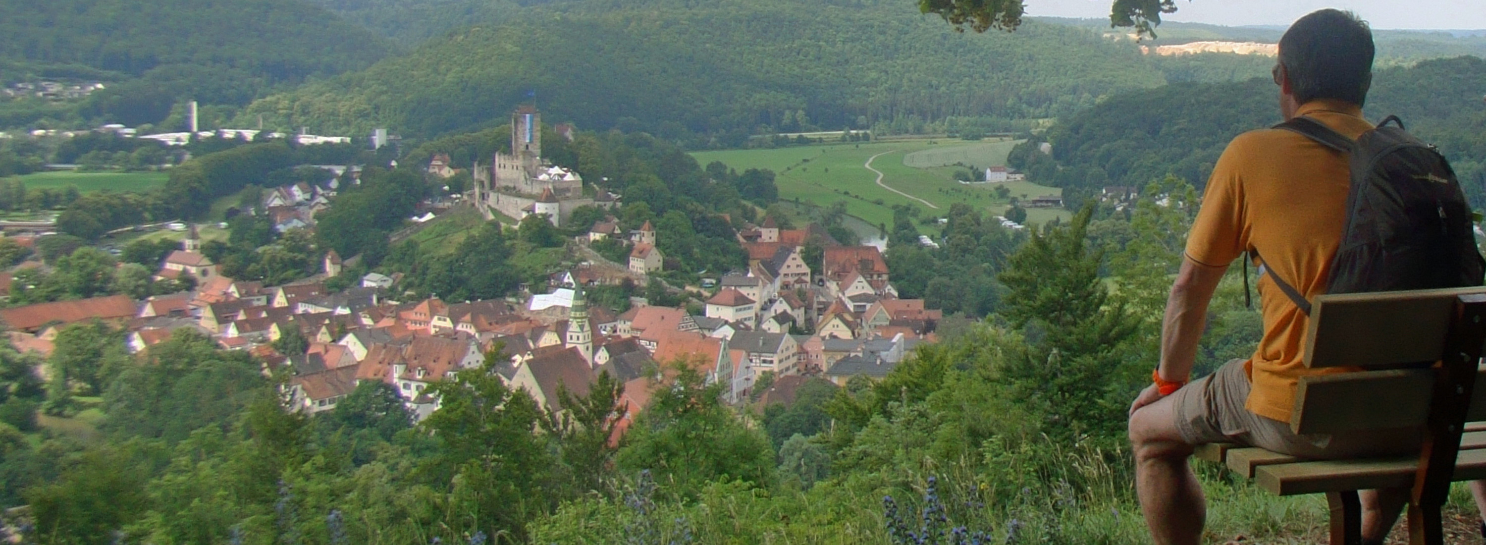
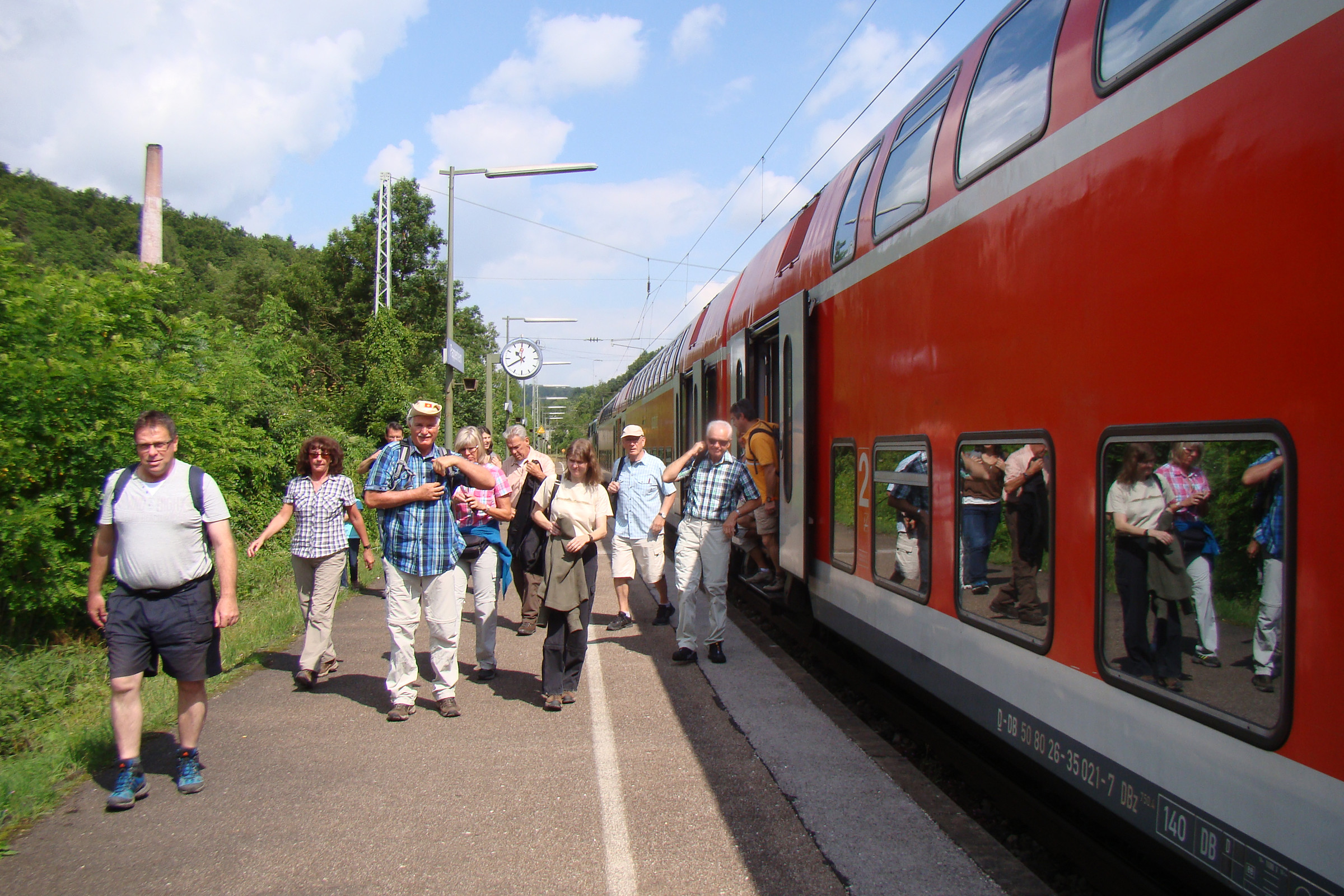
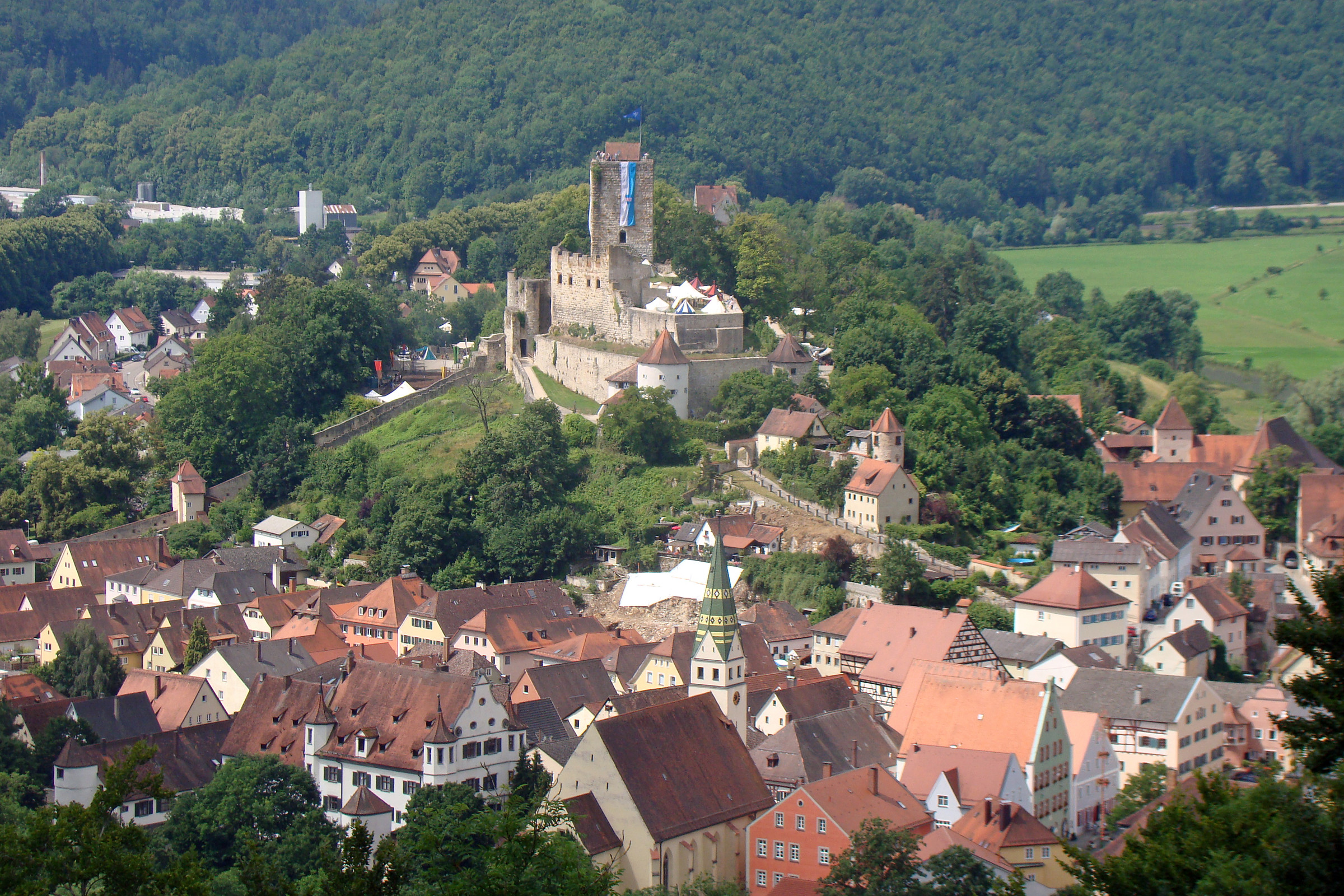
Von Pappenheim RB 16, der ehemaligen Residenzstadt der Reichserbmarschälle mitten im Altmühltal, aus starten wir unsere landschaftlich abwechslungsreiche Wanderung. Zunächst hinauf auf den Weinberg mit herrlicher Aussicht, dann auf und ab durch ausgedehnte Wald- und Feldpassagen und abwärts ins liebliche Schambachtal zum „Schneckenhaus Gottes“, der St.-Gunthildis- Kapelle. Über ein herrliches Trockental und den Römerbrunnen kann man im Araunerskeller oder in einer der zahlreichen Einkehrmöglichkeiten in Weißenburg RE 60den Tag gemütlich ausklingen lassen.

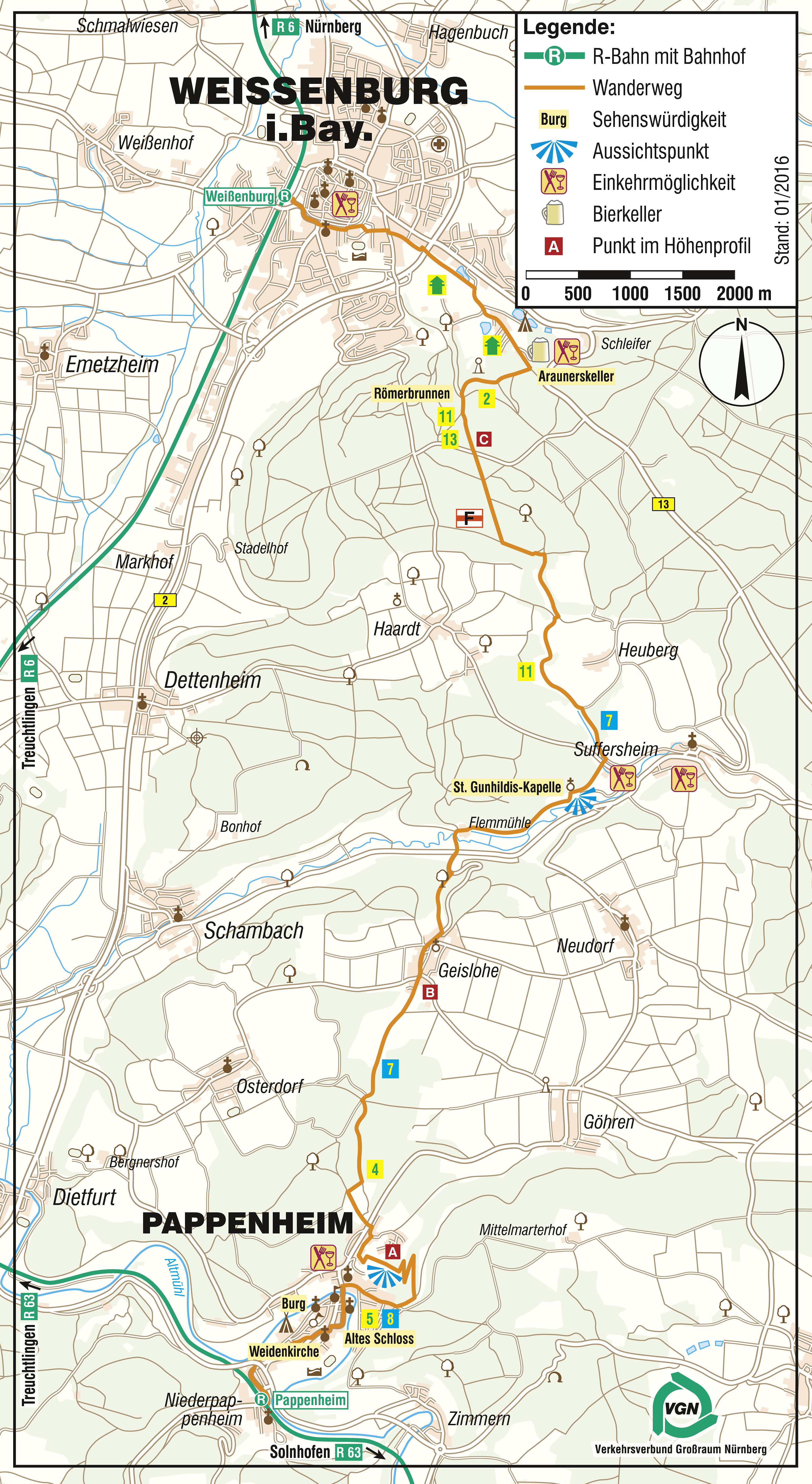

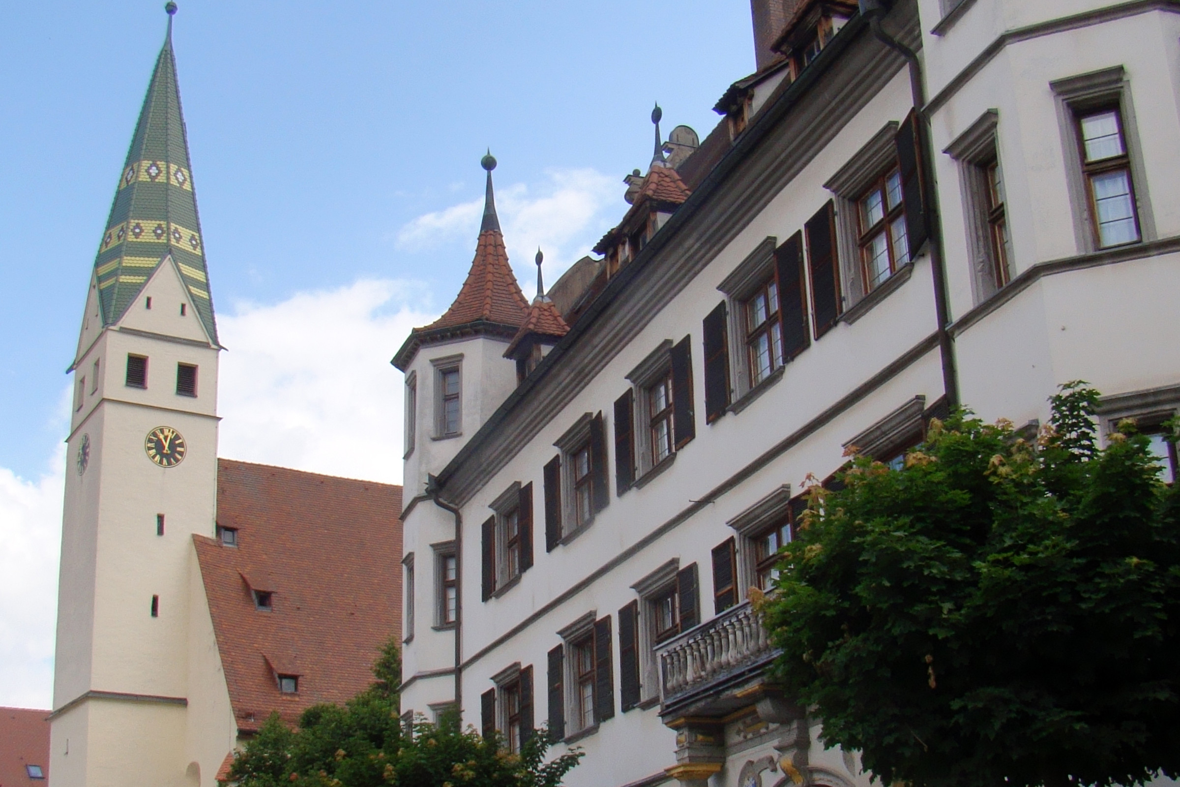
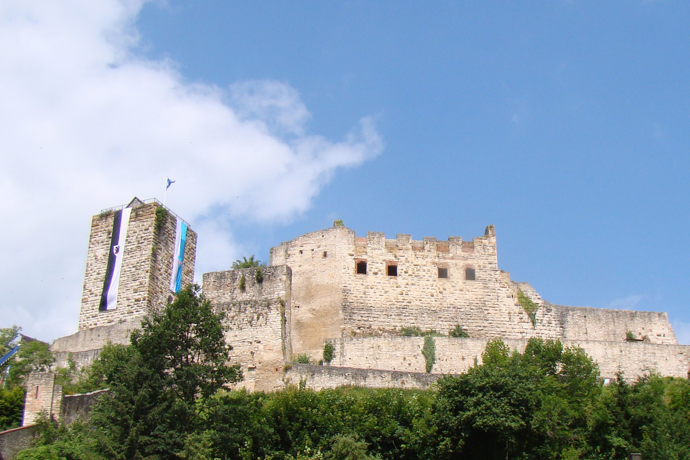
Von Treuchtlingen her kommend geht es in Fahrtrichtung den Bahnsteig entlang, dann nach den Treppen rechts durch die Bahntrasse und im Linksbogen Richtung Innenstadt. Gegenüber dem alten Bahnhofsgebäude weist ein blaues Hinweisschild den Weg in die Altstadt. Vorbei an einer Tankstelle, bleiben wir nach der Unterführung auf dem Fußweg in einer schönen Lindenallee. Wer will, macht einen kurzen Abstecher zur Weidenkirche, einer offenen und natürlichen Kirche, die aus vielen in die Erde gesteckten Bündeln von Weidenruten besteht. Weiter im Bahnweg, bald unterhalb der mächtigen Stammburg der Erbmarschälle und Grafen von Pappenheim, wechseln wir in der Schützenstraße beim Zebrastreifen nach der Kath. Pfarrkirche Mariä Himmelfahrt die Straßenseite. Wieder kurz in der Bahnhofstraße, folgen wir rechts der Bauhofstraße, im Linksbogen dann der Graf-Carl-Straße. Vorbei am Alten Schloss, heute Wohnsitz der gräflichen Familie, und der sehenswerten Stadtkirche St. Marien, erreichen wir den Marktplatz.
Rechts ab, schlendern wir über die Altmühlbrücke und folgen danach den zahlreichen gelben Ausschilderungen des Naturparks Altmühltal und der Stadt Pappenheim nach rechts in die Beckstraße. Bald erneut über einen Zebrastreifen, danach rechts, es geht immer noch in der Beckstraße auf einem Pfad an einer Baumreihe entlang bis an den Stadtrand (Rastbänke und Infotafeln).

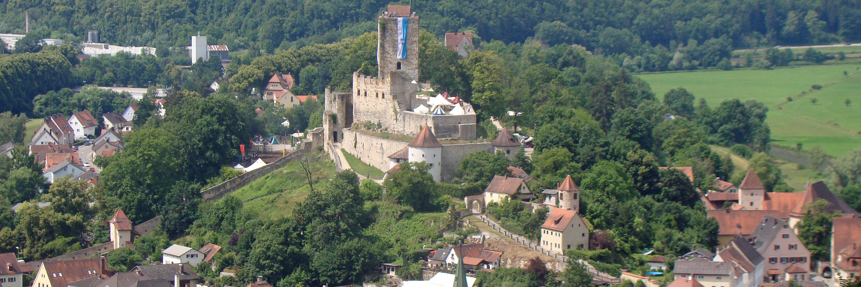
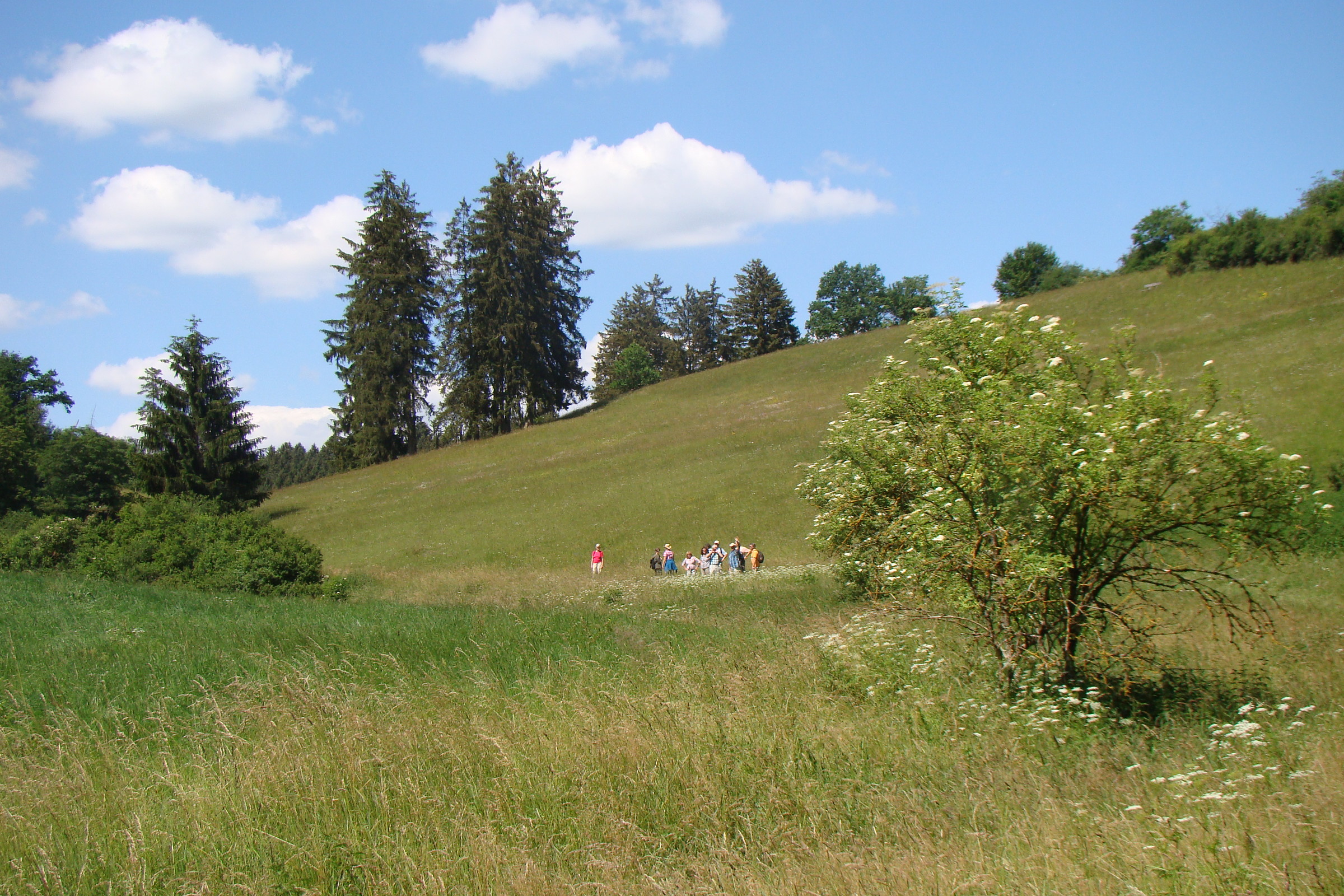
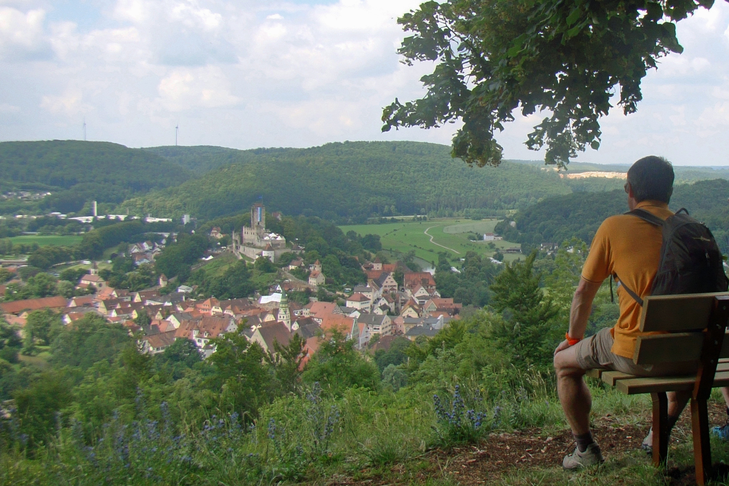
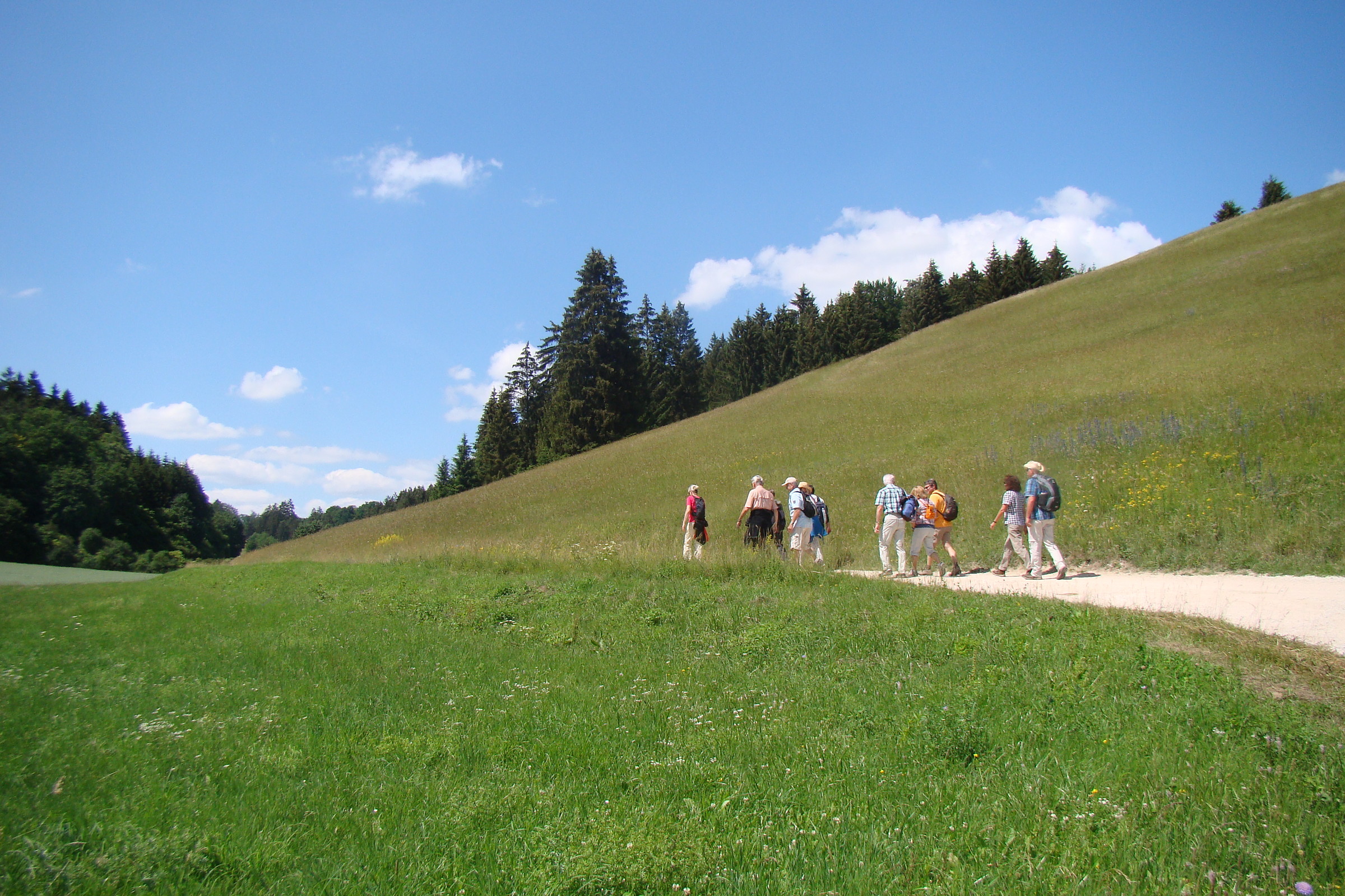
Das Wegezeichen des Ortswanderweges 5 und das der Schlaufe 8 des Altmühltal-Panoramaweges führen uns von hier aus linker Hand hinauf zu einem herrlichen Ausblick über Pappenheim und eine romantische Schleife der Altmühl. Nur kurz noch eben auf dem breiten Forstweg, dann links ab, führt der Weg geradeaus, bald an einem Zaun entlang. In zwei langen Kehren steigen wir nun auf einem schmäler werdenden Pfad im Mischwald stetig aufwärts, später an Felsen vorbei bis zu einem breiten Querweg, dort links. Noch ein Stück den Weinberg hinauf, werden wir bald mit einem herrlichen Panoramablick belohnt, Rastbank und Pavillon inklusive!
In einer Allee mit schönen Hangabschnitten und Ausblicken verlassen wir auf dem Schlaufenweg 8 gemächlich den Aussichtspunkt. Serpentinenartig durch Gartenanlagen geht es hinab bis zu einem geteerten Querweg. Hier dann rechts, wieder mäßig ansteigenden nach oben und „An der Stöß“ im Linksschwenk hinunter zur nach Göhren führenden Straße.
An der Bushaltestelle queren wir diese Straße geradeaus und weiter in der „Schlaufe 8“ aufwärts. Der grasige Weg verläuft zwischen den Feldern und mündet dann in einer größeren Wegekreuzung.
Themenwechsel auf dem nächsten Abschnitt: die örtliche 4 – rechts ab – ist kurzfristig angesagt. Zunächst am Waldrand entlang und bei der folgenden Gabelung links in den Wald hinein. Der breite Forstweg trifft zunächst auf einen Querweg, hier rechts bis zu einer Wegespinne. Die Ausschilderungen zur Schlaufe 7 des Altmühltal-Panoramaweges übernehmen nun die Regie auf dem Weißenburger Reichsstadtweg, zunächst hinauf nach Geislohe und weiter zur St.-Gunthildis-Kapelle. Moderat ansteigend wandern wir aus dem Wald hinaus, dann über die Jurahochfläche und letztlich durch eine Heckenreihe geradeaus in das an die 550 m hoch gelegene Geislohe. (km 7,5)
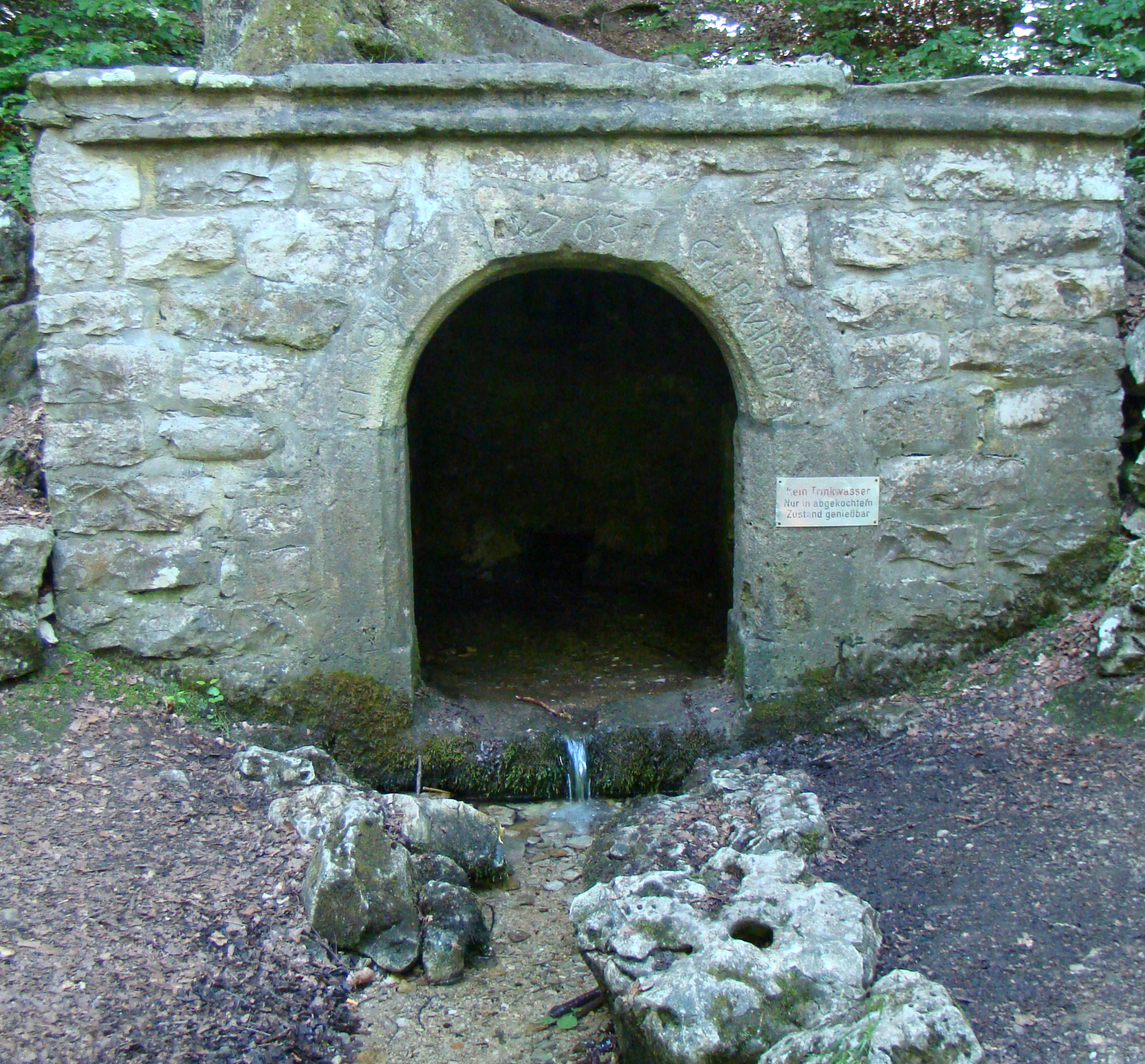
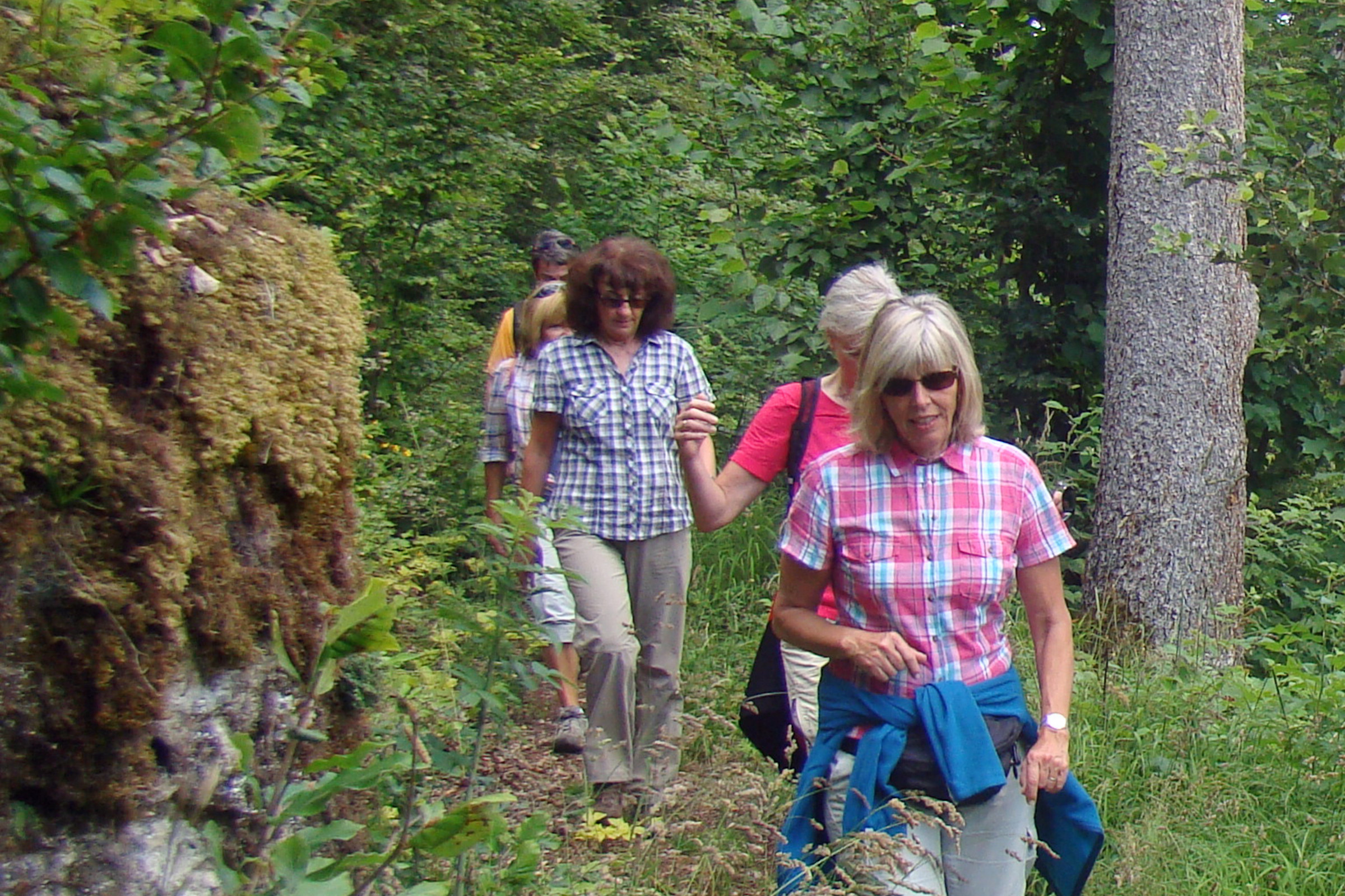
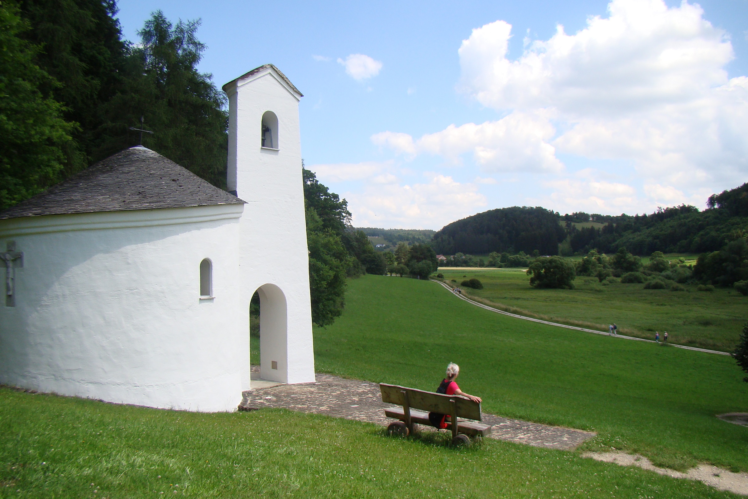
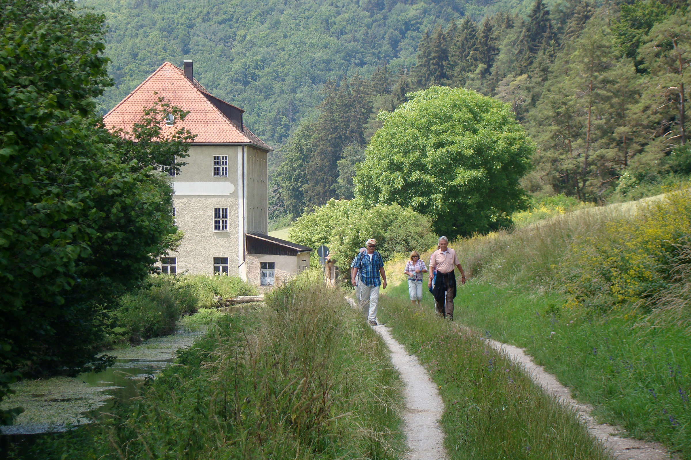
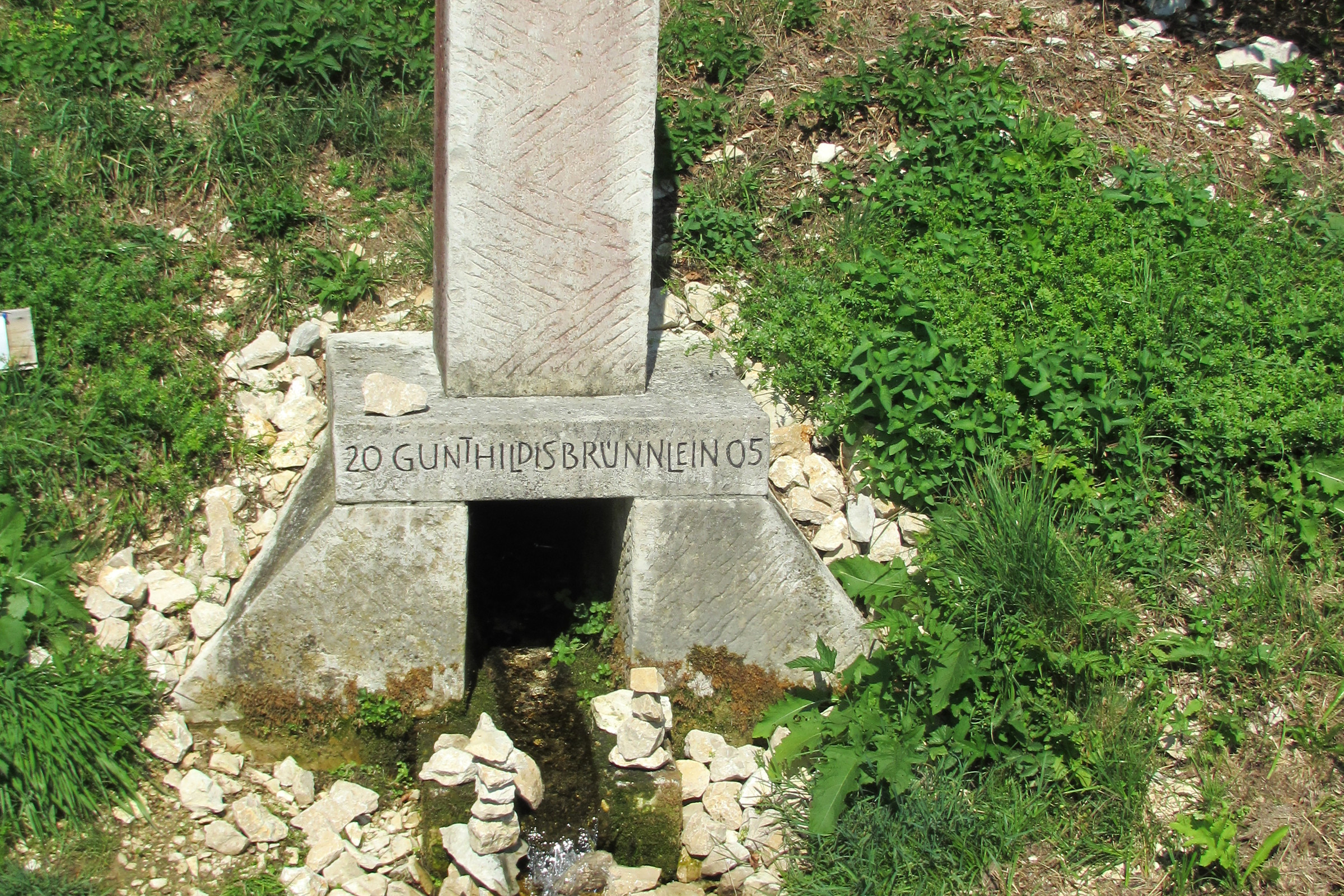
In dem noch zu Pappenheim gehörenden Ort mit manch schmucken Anwesen bleiben wir konsequent auf der Vorfahrtsstraße und verlassen das Dorf nach einem Rechtsbogen am Ortsendeschild nach links. Auf dem Wiesenweg hinunter ins Schambachtal, einem Seitental des Altmühltales, kann man nicht fehlgehen. Unten dann nur wenige Meter auf der von oben kommenden Straße, dann geradeaus und über den Schambach und danach rechts zur Flemmühle. Nach der kleinen Einöde geht es zunächst am gefassten Mühlbach entlang, später folgen wir, vorbei am Gunthildisbrünnlein, dem Schambach, der bei Dietfurt in die Altmühl fließt. Links am Hang dann die ökumenische St.-Gunthildis-Kapelle, zu der wir aufsteigen.


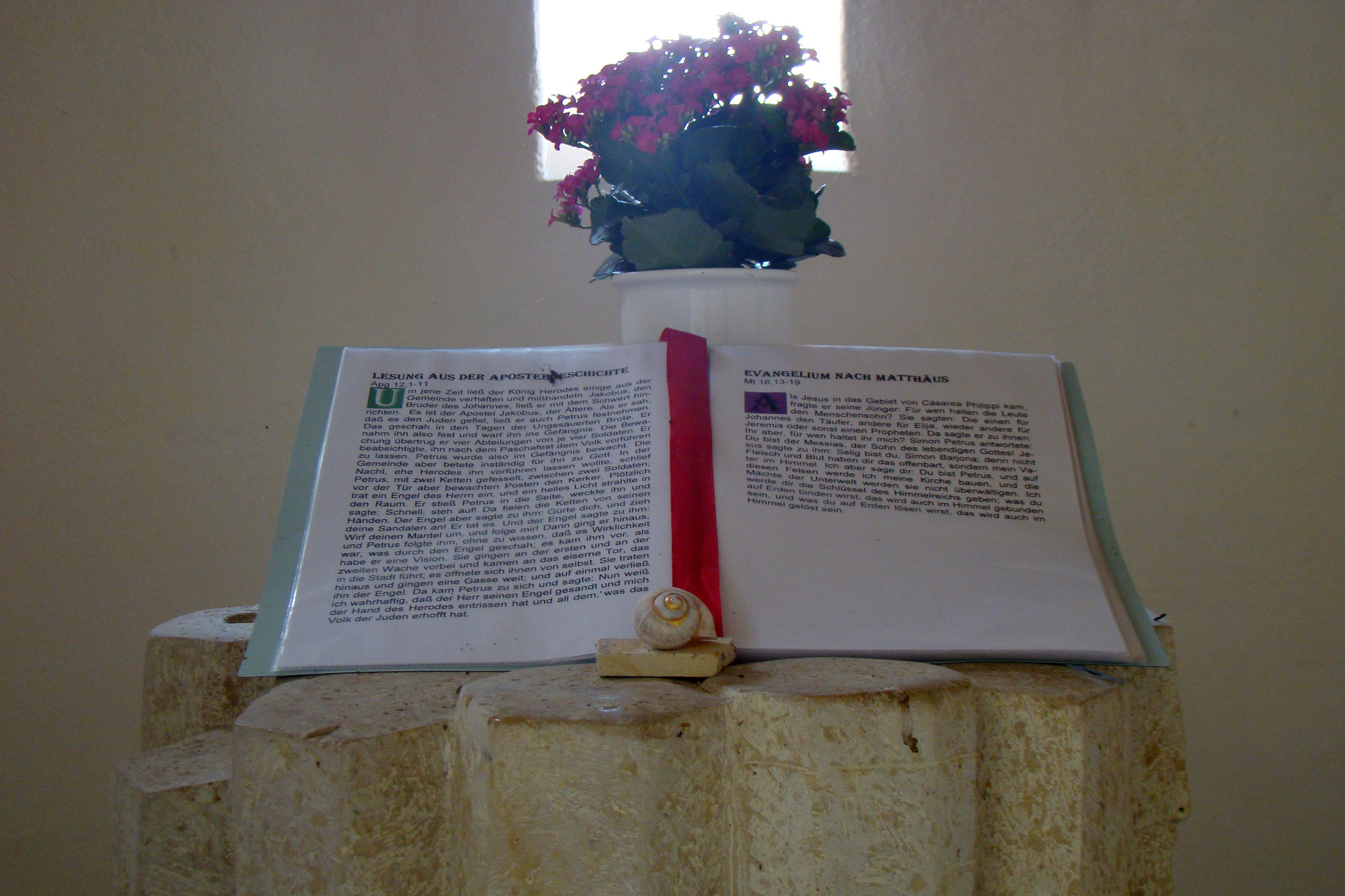
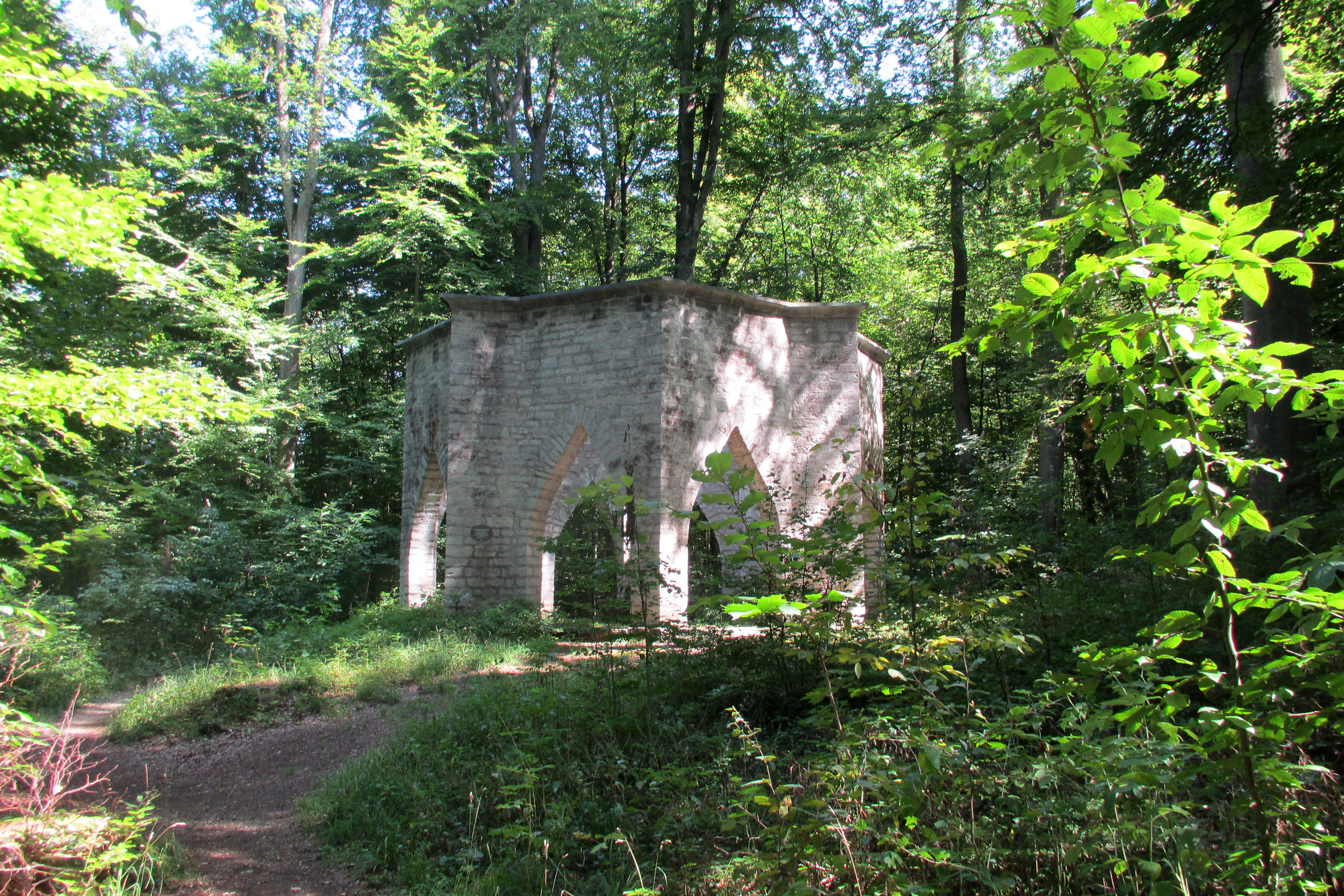
St.-Gunthildis-Kapelle
Im Jahre 1995 erbaut, wird sie wegen ihres Grundrisses in Form eines Ammoniten im Volksmund „Schneckenhaus Gottes“ genannt. Gleich unmittelbar links daneben: die im Jahre 2000 freigelegten Fundamente der ehemaligen Kapelle. Durch den Schneckeneingang gelangt man in das Innere der Kapelle, das sein Licht nur aus drei kleinen Fenstern bezieht. Infotafeln und Prospekte geben weitere Auskünfte.
Siehe auch: www.vgn.de/wandern/gunthildis.pdf
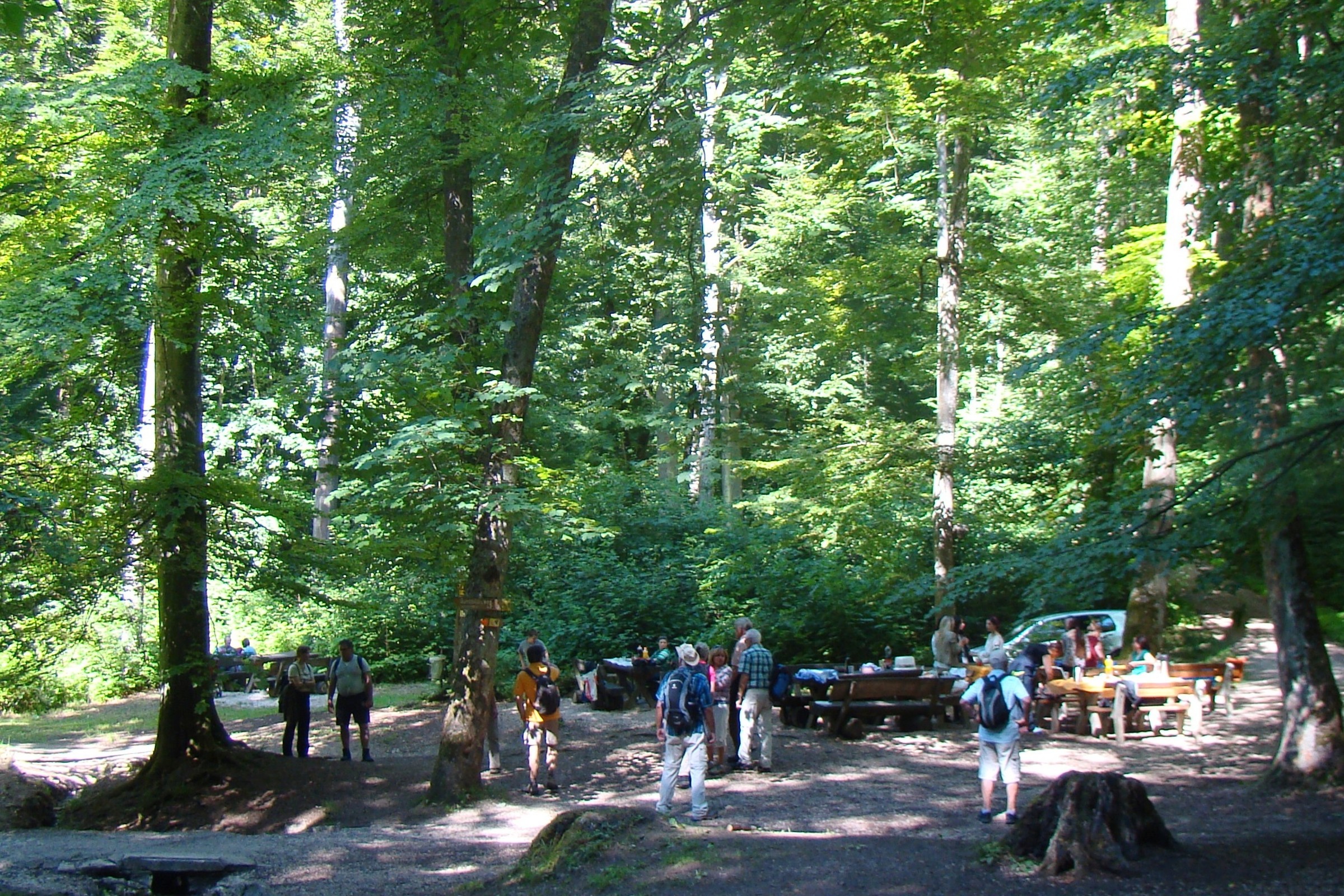
Nach dem Abstecher geht es rechts neben der Kapelle noch ein paar Schritte aufwärts, im Wald dann rechts und eben vor zu einer ersten Einkehrmöglichkeit, allerdings nur Freitag–Sonntag ab 11 Uhr. (km 10,8)
Von und nach Suffersheim Waldhof und Suffersheim Mitte bestehen Fahrtmöglichkeiten mit der Buslinie 698.1
Ausgangspunkt für den weiteren Weg Richtung Weißenburg ist der Wanderparkplatz gegenüber der Bushaltestelle Waldhof – Standortbestimmung an den Info- und Wandertafeln. Nach wie vor befinden wir uns auf dem Weißenburger Reichsstadtweg. Entsprechend bleibt das Wegezeichen das der Schlaufe 7 des Altmühltal-Panoramaweges. Gelegentlich hilft die oft unterschiedlich dargestellte 11 noch zusätzlich. Ein wunderschöner Talweg verläuft, ohne abzuzweigen, zunächst stets im Talgrund und lässt die Herzen eines jeden Wanderers in diesem Abschnitt des Seitentals höher schlagen.
Bei einem „einseitigen Strommasten“ wird der Untergrund grasiger. Im folgenden Rechtsbogen um eine Kuppe herum, heißt es aufgepasst: Hier zweigt ein meist ausgetretener Wiesenpfad unvermittelt – links auf eine Heckenreihe zu – ab. Die blau-gelben Wegezeichen sind vor diesem Durchlass gegebenenfalls im hohen Gras nur schwer sichtbar!
Gleich nach der Hecke rechts, führt bald ein breiter Wiesenweg nun auf der anderen Talseite vor zu einem geschotterten Querweg. Nur ca. 20 m mit der 7 nach rechts, dann gleich wieder links, bestätigt das blau-gelbe Wanderzeichen, nun zusammen mit der 11 an einem Holzpfosten angebracht, den richtig eingeschlagenen Weg. Im Tal bleibt der Weg noch grasig, bevor er als Pfad in den Wald hineinführt und in einer Kurve in einem breiten Forstweg mündet. Links ab folgt ein gerader Abschnitt, nach dem im anschließenden Rechtsbogen der Frankenweg  von links kommend zu uns stößt.
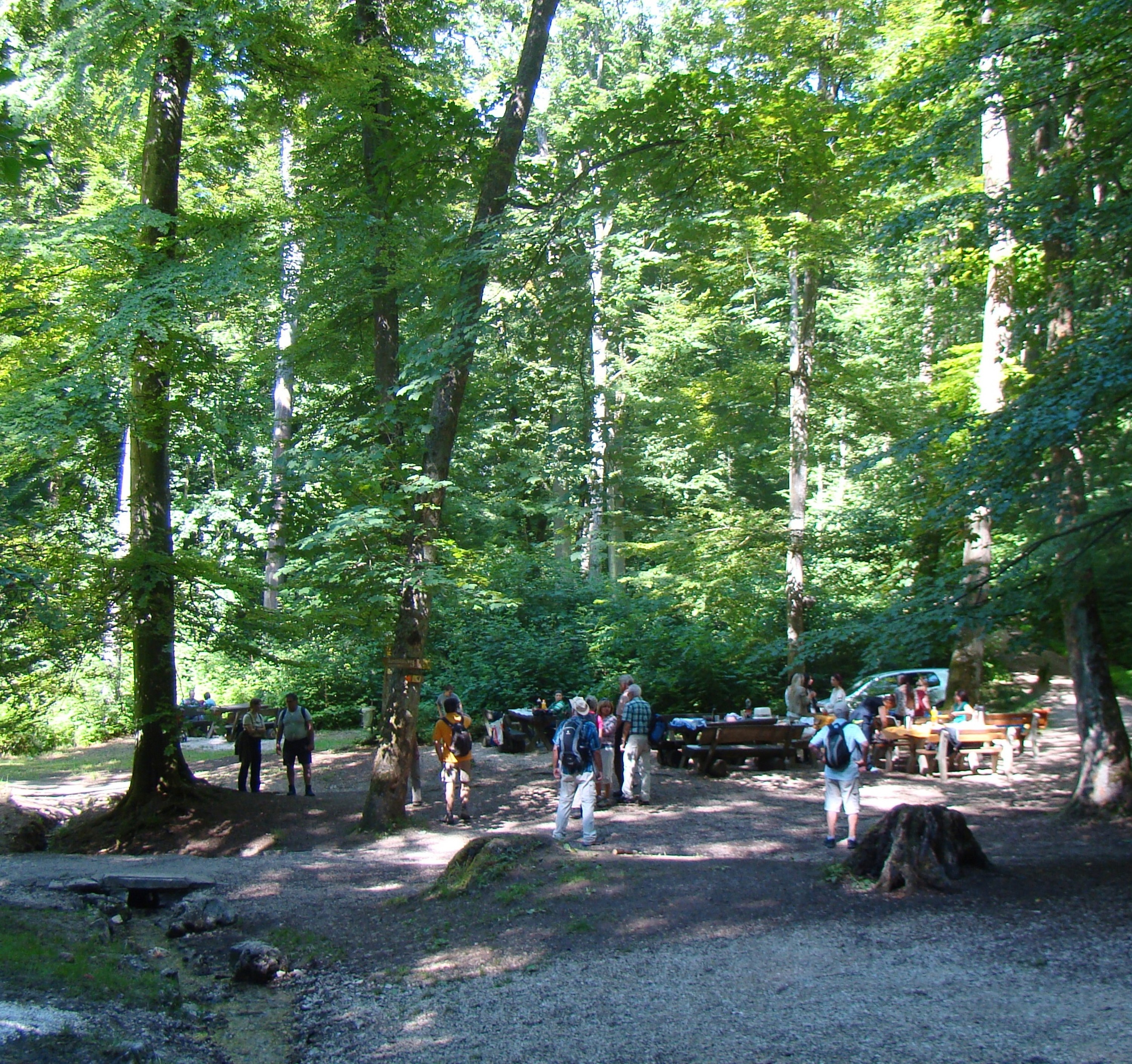
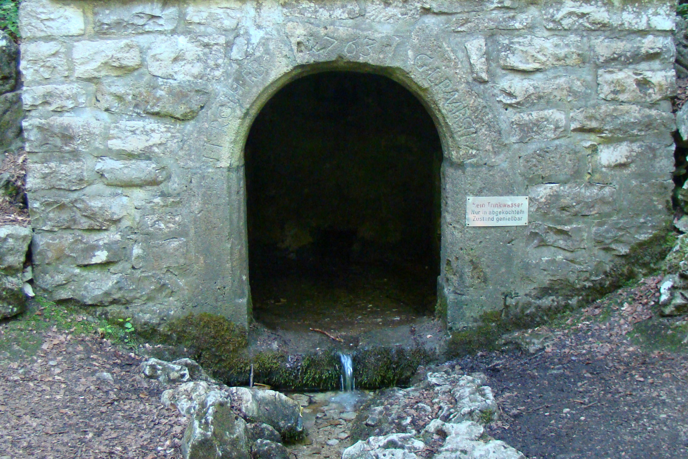
Erneut folgt ein ziemlich langes, gerades Teilstück. Bei der nächsten Gabelung (Sitzbank) verlassen uns die vertraute 7 und der Frankenweg nach rechts, wir bleiben geradeaus. Über ein Teersträßchen „der Nase nach“ weiter, übernimmt nun wieder die 11 auf dem kurzen Stück durch den Mischwald Richtung Römerbrunnen. Kurz davor passieren wir eine Wegekreuzung mit zahlreichen Hinweisschildern sowie einer Ruhebank und folgen der 11 und 13 weiter geradeaus. Kurz danach serpentienenartig steil abwärts, erreichen wir bald das vielbesuchte und vielseitige Areal des Römerbrunnens.
Die Sage vom Römerbrunnen
Einst, so wird berichtet, hielt sich hier eine römische Kohorte auf. Einer der Legionäre stieß auf ein Mädchen, das vor Angst flüchtete. Der Römer wollte es zu seiner Sklavin machen, verfolgte es, holte es schließlich ein. Da trat sie mit erhobenem Speer dem Römer entgegen. Der Römer zückte sein Schwert und tötete die Germanin, die er dann begrub. Nun wollte er zu seinen Soldaten zurück und stellte fest, dass er sich verirrt hatte. Im Wald entdeckte er eine Quelle und ging dem Lauf des Bächleins nach, das ihn zurück zu seiner Kohorte führte. Dort beschrieb er den günstigen Lagerplatz auf der Anhöhe. Die Römer bauten ihn zu einem Stützpunkt aus und fassten die Quelle zu einem Brunnen.
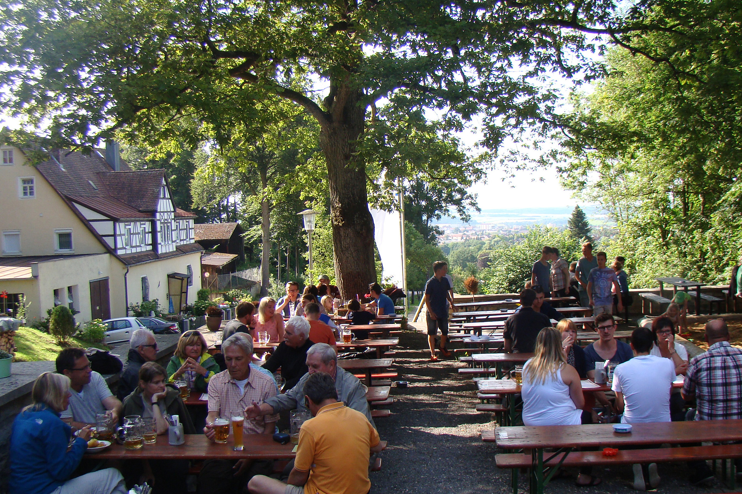
Zum Araunerskeller:
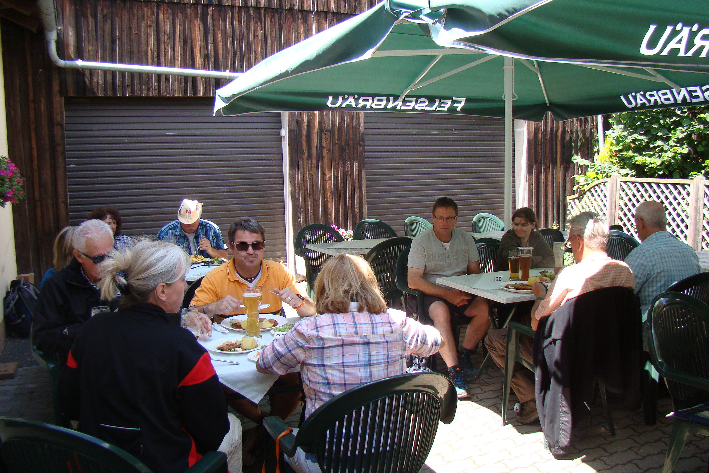
Weiter abwärts queren wir ein kleines Bächlein und folgen ab hier u. a. dem Wegezeichen 2 halbrechts, die 13 verlässt uns nach wenigen Metern wieder. Vorbei am Kriegerdenkmal, bleibt die 2 unsere Markierung, die uns nach rund 100 m weiter die Richtung vorgibt. Die Station des Waldlehrpfades mit einem Früchtekalender und Klanghölzern sorgt für Abwechslung. Bei einem Abzweig verlässt uns die 6 nach rechts. Bei der nächsten Kreuzung schwenken wir ohne Ausschilderung nach links und kommen auf dem Teersträßchen direkt zu den schon sichtbaren Kelleranlagen. (km 16,5)
Rund 45 Minuten sollten Sie für den Weg zum Bahnhof einkalkulieren!
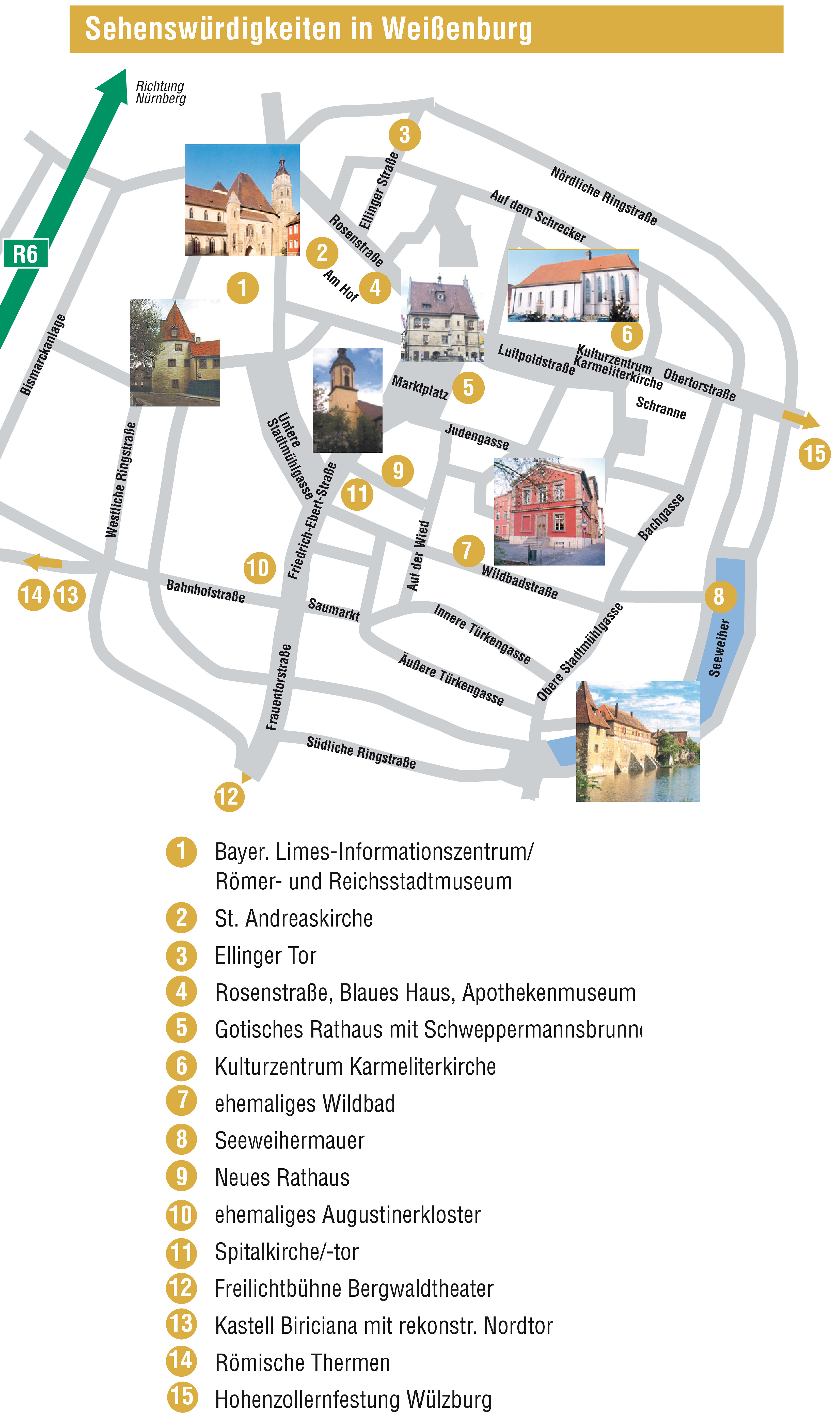
Der Weg dorthin führt über die Straße „An den Sommerkellern“ abwärts, gut ausgeschildert mit dem Wegezeichen des Weißenburger Römerweges als Begleiter bis zu den Weihern an der Stadtmauer. Auf dem Weg nach unten folgen wir bald linker Hand einem geteerten Fußweg am Aumühlweiher entlang, dann durch eine Unterführung und nach links in die Straße „Am Volkammersbach“.
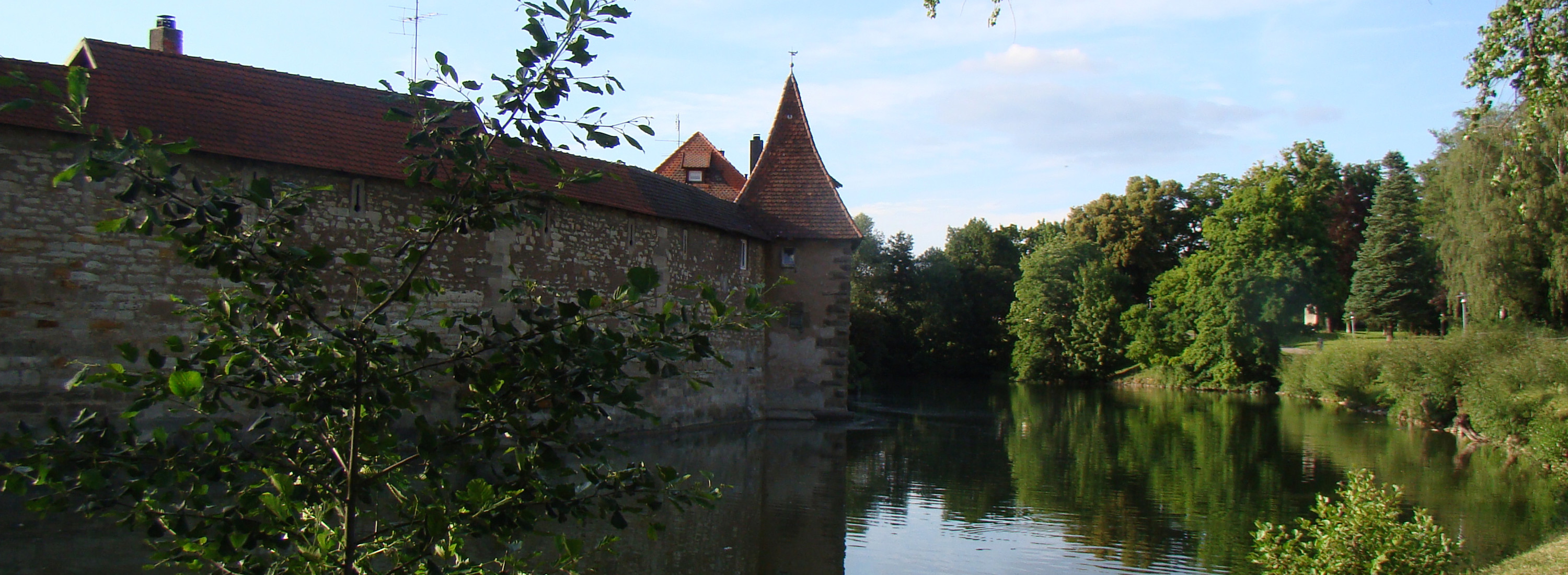
Dieser Straße folgen wir bis zum querenden Römerbrunnenweg, dort kurz rechts und links hinein in die Straße „An der Hagenau“. Nach den beiden Schulzentren dann rechts ab und vor zum Seeweiher an der historischen Stadtmauer, dort links. Am Ende des Seeweihers stets geradeaus, ist der Weg zum Bahnhof RE 60 bald ausgeschildert.
Natürlich bieten sich auch innerhalb der Stadtmauern vielseitige Einkehrmöglichkeiten, um den Tag ausklingen zu lassen. Mehr dazu unter www.weissenburg.de/gastronomie
Weitere Informationen zu Weißenburg finden Sie auch online in unserer Städtetour!

Bitte informiere Dich in Deinem eigenen Interesse vorab über die aktuellen Öffnungszeiten und Ruhetage. Korrekturen können an freizeit@vgn.de gemailt werden.


Cookie-Einstellungen
Unsere Webseite verwendet Cookies. Diese haben verschiedene Funktionen.
Die Einwilligung in die Verwendung der nicht notwenigen Cookies können Sie jederzeit widerrufen. Weitere Informationen zu den von uns eingesetzten Cookies finden Sie in unserer Datenschutzerklärung.
Zur Teilnahme an Gewinnspielen müssen die notwendigen Cookies aktiviert sein. Weitere Informationen finden sie im Datenschutz.